Spatial-temporal analysis of the public transportation network of Zürich in R
Basierenden auf den Fahrzeiten der VBZ im SOLL-IST-Vergleich analysieren Manuel Bär und Alexandra Kessler das öffentliche Verkehrsnetz in Zürich. Entstanden ist das wissenschaftliche Paper am Geographischen Institut der Universität Zürich.
Abstract
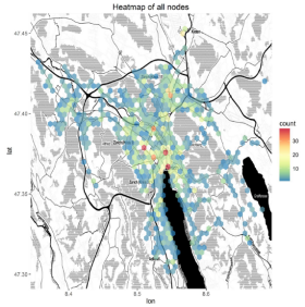
Public transportation is of growing importance in Switzerland. The steady increase of commuters using this mode of transportation has an impact on the infrastructure and characteristics of the public transportation network. Spatiotemporal problems arise which have a negative influence on the client satisfaction. In this paper we analyzed various aspects of the public transportation system in Zurich, including the daily mean delay times and the detection of problematic nodes. We analyzed a large dataset from OpenData Zürich using R by creating various maps, diagrams and a video. Two different delay propagation types (line following and network spread) are identified and discussed. We detected large intra-daily fluctuations in delay times of public transportation services and large inter-daily similarities. A significant difference in the delay times of public transportation services between weekdays and weekends is noticed. Various societal structure characteristics are identified using the delay times as a proxy and event detection is discussed. Problematic nodes are found in Dietikon, Seebach and the Main Train Station. We suggest further research be done regarding delay propagation through public transport networks and the detection of network spread epicentres including the affected lines.
